


Download PDF

The Hectares Indicator: Chiapas State, Mexico
Technology Category
- Analytics & Modeling - Real Time Analytics
Applicable Industries
- Agriculture
Services
- Data Science Services
The Challenge
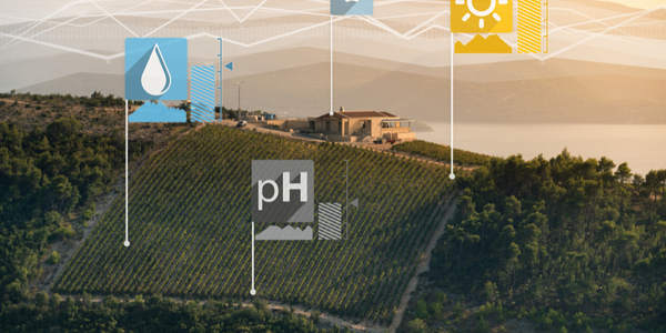
The Hectares Indicator (HI) was developed to assess the effectiveness of interventions aimed at avoiding forest loss and promoting climate-smart land use. The toolkit is designed to answer the question: How much deforestation are we avoiding through our project’s interventions? The core of the HI toolkit is the establishment of a reference level from which users can estimate expected forest loss within a specific area. The toolkit recommends creating a risk map by considering factors that increase risk of forest loss in four categories; forest accessibility, potential for cultivation, extractable value and protection status. Once this risk or reference level map has been produced, users upload the map along with actual forest loss data to their Mapping Platform application where they can adjust a pre-written query that automatically calculates and produces summary results for expected forest loss, actual forest loss and avoided deforestation.
About The Customer
The customer in this case study is ECOSUR, a Forests 2020 partner in Mexico. ECOSUR has applied the Hectares Indicator to present results for avoided deforestation in three regions of Chiapas state – Sierra Madre, Marques de Comillas and Reserva El Ocote. To create their risk map, ECOSUR considered risk factors within three categories: Accessibility - proximity to road, rivers and water bodies, and topography (slope); Social/Economic - population density, distance to sites with agricultural land use, marginalization rate and distance to villages; Protection - protected areas (risk reduction factor). These variables were spatially analyzed, then compared with the location of deforestation events to determine the risk classes. The team also utilized data from a local region within Chiapas state to determine the final categorizations of risk.
The Solution
The solution provided by the Hectares Indicator toolkit is the establishment of a reference level from which users can estimate expected forest loss within a specific area. The toolkit recommends creating a risk map by considering factors that increase risk of forest loss in four categories; forest accessibility, potential for cultivation, extractable value and protection status. Once this risk or reference level map has been produced, users upload the map along with actual forest loss data to their Mapping Platform application where they can adjust a pre-written query that automatically calculates and produces summary results for expected forest loss, actual forest loss and avoided deforestation. After the first HI results are produced, the toolkit is intended to be implemented as a light-touch, cost effective and quick annual reporting tool.
Operational Impact
Related Case Studies.
Case Study
Intelligent Farming with ThingWorx Analytics
Z Farms was facing three challenges: costly irrigation systems with water as a limited resource, narrow optimal ranges of soil moisture for growth with difficult maintenance and farm operators could not simply turn on irrigation systems like a faucet.

Case Study
Greenhouse Intelligent Monitoring and Control Solution
Farming Orchids is the most successful form of precision farming in Taiwan, and also the most exported flower. Orchids need a specific temperature and humidity conditions to grow and bloom, and its flowering time may not be in line with market demands, so the price collapses when there is overproduction. Therefore, some farmers began to import automated greenhouse control systems for breeding and forcing, which not only improves quality, but also effectively controls the production period and yield to ensure revenue. In 2012, an orchid farmer built a Forcing Greenhouse of about 200 pings (approximately 661 Square Meters) in Tainan, Taiwan. The system integrator adopted Advantech’s APAX-5000 series programmable automation controllers to build the control platform, coupled with Advantech WebAccess HMI/SCADA software, to achieve cloud monitoring. The staff of the orchid field can monitor important data anytime via smart phone, iPad, and other handheld devices, and control the growth and flowering conditions. System requirements: In the past, most environmental control systems of orchid greenhouses in Taiwan used PLCs (Programmable Logic Controller) with poorscalability and control, and could not be connected to the Internet formonitoring from the cloud. For advanced database analysis and networking capability, the PC platform must be adopted. Therefore, PAC Systems (Programmable Automation Controller) with both PLC programming capabilities andPC functions is a better choice.The environmental control of the Orchid greenhouse switches on and off devices like fan, shade net, cooling/heat pump, liquid flow control, water-cooling wall etc. It is controlled by a control panel of electric controllers, and is driven by a motor, to adjust the greenhouse temperature, humidity, and other environmental conditions to the set parameters.
Case Study
Enabling Internet of Things Innovation in Agriculture
DigiBale, wanted to apply technology know-how and IP from implementations successfully to more agriculture sectors including cotton, forestry, sugarcane and cattle. However, farmers and growers still have worries about the connected technology.
Case Study
Precision beekeeping with wireless temperature monitoring
Honeybees are insects of large economic value and provide a vital service to agriculture by pollinating a variety of crops. In addition, bees provide us with valuable products such as honey, beeswax, propolis, bee venom, etc. Monitoring of honeybee colony health, population, productivity, and environmental conditions affecting the colony health have always been exceedingly difficult tasks in apiculture. Research has shown that even small deviations (by more than 2°C) from the optimal temperatures have a significant influence on the development of the brood and the health of adult bees.
